Updated: Dec 26th, 2005
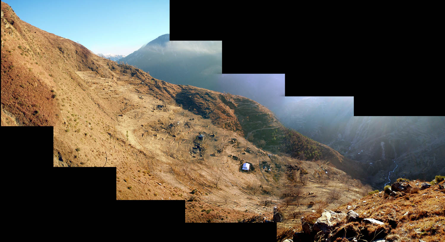
Click on the image to see the full size stitched-together panoramic of Katta Mangial, a village in the Shukrah mooza of the Hungarai UC of the Mansehra District. (Confused? You don't know the half of it.)


Some of the views.

Winter is here.

The mountain they call Makra, well up a valley in the Ghanool UC. On the other side of this mountain is Kashmir.

Couldn't resist.

Many graves were disturbed by the earthquake.

A graveyard on the side of a hill looking into the Kaghan valley. The fresh graves are on the right, covered in plastic so as not to wash away when the rains come.


All over the earthquake affected areas there are large cracks in the earth, threatening future landslides or shifts. Some big, some small, some menacing, some harmless. Like landslides and collapsed buildings, they mark this landscape so strongly that a newcomer gets too accustomed to them. One of the biggest motivations for people to evacuate this particular area was these cracks: when the rains and snow start this winter, the potential for further sliding of the land will greatly increase (especially in combination with general deforestation and further aftershocks.)


This is the traditional local method of storing corn for the winter. Some (not most) of the corn crop was left unharvested. A few goats and other animals roam through the fields and collapsed houses, scavenging what they can find.

Many terraces on steep slopes have been covered by landslides. Others, like this one, were not covered but received a number of boulders and a shower of small rocks (pictured) that will interfere with future efforts to rebuild livelihoods.

A local climbed a persimmon tree to grab us a couple fruits.


Trees all over these hillsides bear the characteristic shape shown on the left (not usually so pronounced) from rocks falling in prior years. On the right, a more recent alteration.


Many of the trails in these areas have been created anew, as the old routes are often obliterated by landslides or too dangerous too pass. Those who once knew their way around have to learn new, usually much longer ways, up and over ridges, across waters where no bridges were previously needed, and through piles of boulders. These trails occasionally traverse the landslides. These pictures truly do not depict how treacherous some of these crossings can be. The footfalls visible here are basically depressions in soft, loose rock and dirt which is only barely stable. The angle is perilous, and the distance to the next place of rest often enormous.
The biggest problem with this scenario is for the local people who are expected to carry heavy loads of corrugated galvanized iron, food, and other supplies in these regions.
Actually, almost all the population of the particular areas in these two photographs have left for the winter, leaving them ghostly empty, but this same situation remains problematic for the high percentage of people remaining in the Allai valley and many other areas.

In the Kaghan valley, the distribution point and base maintained by ACTED includes one of the very large UN World Food Program tents. In a recent aftershock measuring 5.7 some of the stacked goods were knocked over inside this tent.

Some of ACTED's staff working the logistics in the tent. A lot comes in and out of these hubs every day. Making sure it gets to the right place at the right time amidst all the chaos is a big job.

At another distribution point, Hungarai, foam is unloaded from a truck. This is part of the crucial "winterization" of tents and structures: this foam is used as insulation in structures that are otherwise virtually useless.

One of the enormous ACTED trucks. ACTED has been working in Afghanistan for a long while and so were able to respond very quickly and effectively. These trucks were driven in from that program and serve the cause well with their high weight limits and ability to handle the local terrain.